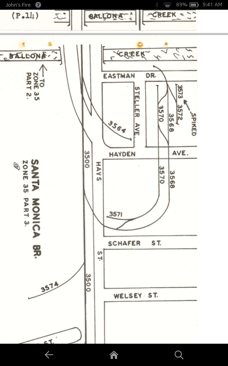
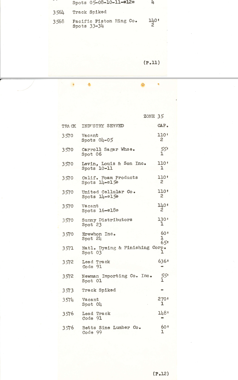
I was recently given a copy of a 1976 Southern Pacific SPINS (Southern Pacific Industrial Numbering System), which is a track map given out to train crews. I was originally looking at it for more information about the old Pacific Electric Santa Monica Airline when my eyes were drawn to Culver City, CA. While it doesn't show the buildings, it does show all streets and tracks, plus the length of all spurs....while I have no desire to model this, it is too neat of a prototype to pass up for someone who wants to do some urban industrial modeling....

